SURVEY SERVICES
Search and Salvage
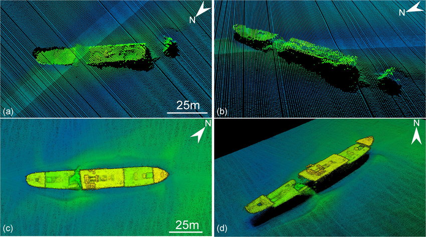
PT. Geotindo Survey Services excels in conducting high-level mapping projects tailored for marine search operations across Indonesia. Our expertise in search and salvage operations is unmatched, as we leverage advanced technologies and specialized methodologies to precisely map underwater terrains and identify potential search areas.
With a deep understanding of the unique challenges posed by marine environments, our team is dedicated to providing accurate and timely information crucial for search and salvage missions. Whether it’s locating lost vessels, retrieving valuable assets, or assisting in emergency response efforts, our commitment to excellence ensures that clients receive the highest level of service and support, ultimately contributing to the safety and success of marine operations throughout Indonesia.
What we do:
1. Sonar searches for shipwreck, plane, etc;
2. Unexploded ordinance (UXO) and lost artifacts;
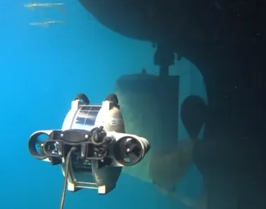
3. Underwater drop video or ROV confirmation;
4. Magnetometer search for ferrous materials;
5. Precise recovery grid mapping for salvage operations.