SURVEY SERVICES
Marine Engineering
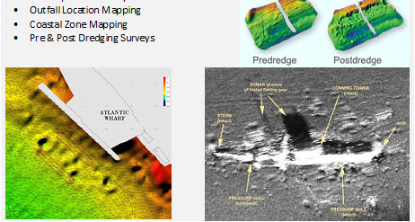
Typical of bathymetry and seabed features
PT. Geotindo Survey Services (GSS) is closely with projects engineers to offer innovative and cost-effective solutions to their marine applications. We deliver high resolution bathymetry charts, surficial sediment/bedrock maps, and depth to bedrock isopach maps showing overburden thickness.